MAT 259 - 2009W
Josh Dickinson | "Culture Map"
Description
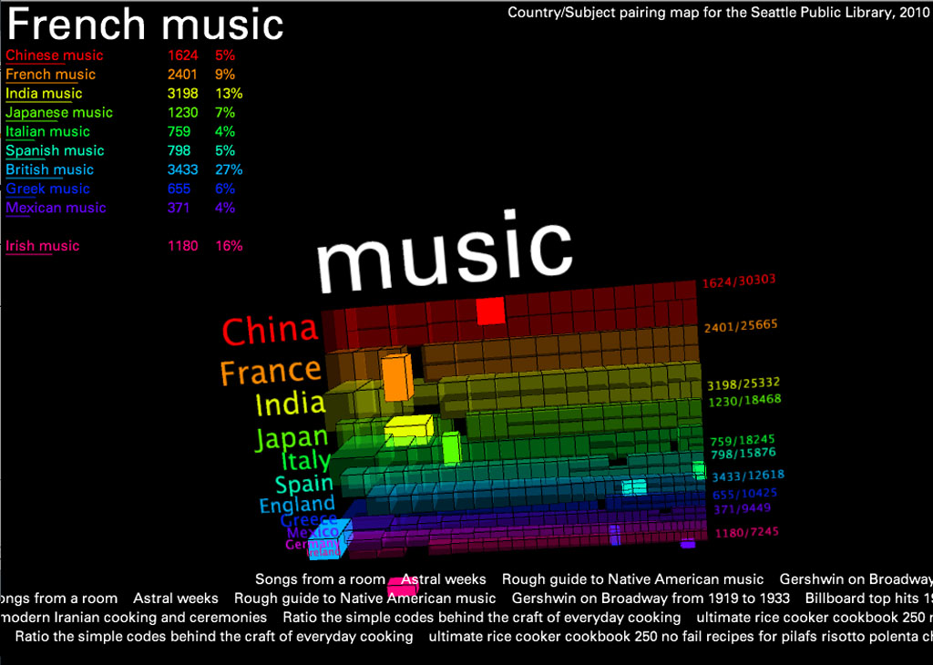
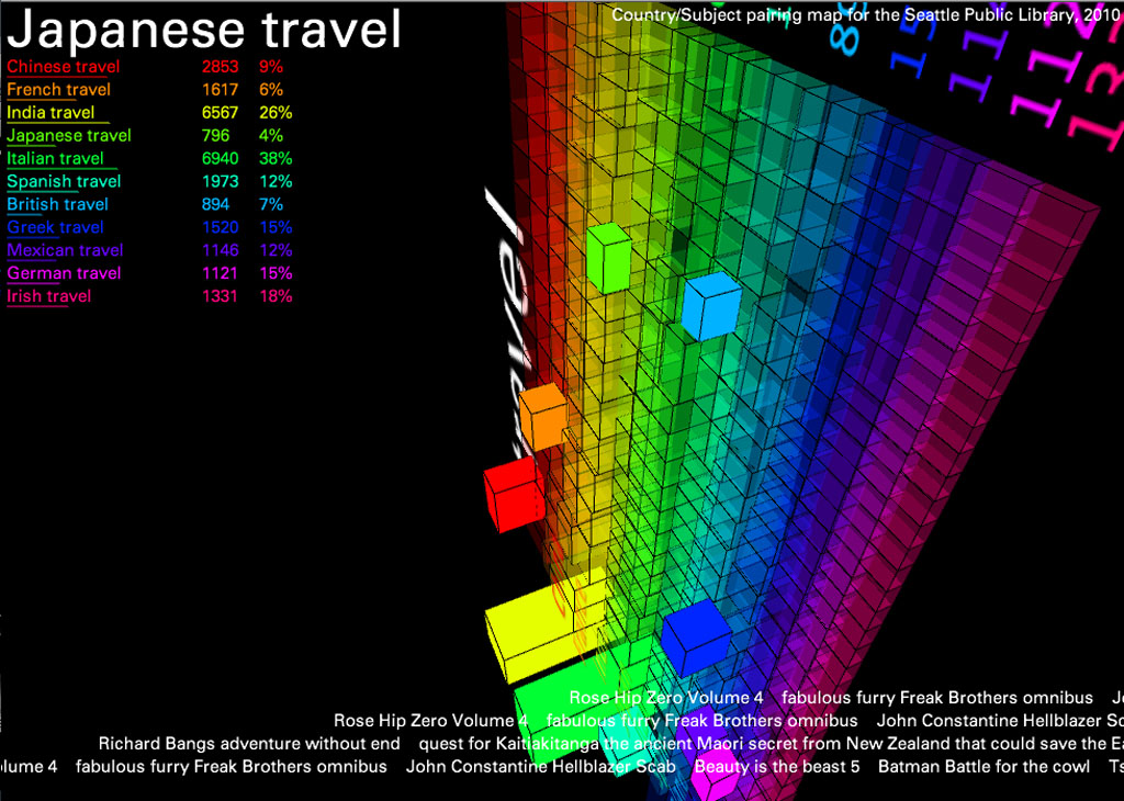
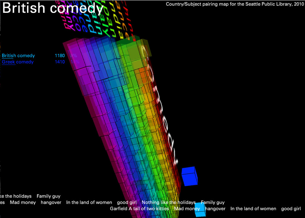
Using circulation data from the Seattle Public Library, I created a 3D map of the 11 most frequently referenced countries and the words most often associated with each from January - December 2010. I did this by collecting the first three subject headings for every item circulated with a title referencing a country in either noun or adjective form (for example, "china" or "chinese"). This created a large text file which I simply parsed in terms of word frequency.
The result reveals interesting patterns: "war" was the word most often associated with Germany, "cooking" and "food" were important categories for every country except England and Ireland (proving the fact that no one likes British food), "women" was one of the most words most associated with France, etc.
To add another layer of information, I've included scrolling "trackers" at the bottom that display actual titles of items containing these subject/keyword pairs (Italian + food, etc.). The countries are listed in order of popularity- China being first- and the 3D blocks can be read as literal representations of the volume of items checked out in each category.
Technically speaking, data manipulation and filtering was done through MySQL in conjunction with some fancy BASH scripts, and all of the visualization was done in Processing.
CONTROLS: Drag the mouse to control the camera angle. Use the Scroll wheel to zoom in/out. Spacebar returns to the original angle if you get lost. The "w" and "s" keys will cycle through countries. The "a" and "d" keys will cycle through subjects.
This project was realized using Processing.
Screenshots

Source code: cultureMap Fetcher Google TheItem TheMapModel
Built with Processing